 Flight tracking today runs on a technology called ADS-B: aircraft continuously broadcast their own position, which is picked up by a worldwide network of ground receivers. Our own radar turns those signals into live updates on the departure, arrival and position of flights, from that network plus our own receiver.
Those updates are plotted in real time on the flight radar on this page. Enter a flight number, registration or callsign and you can look up and follow the aircraft live, anywhere in the world, on any computer, tablet or smartphone. Looking for Flightradar24? On our Flightradar24 page you use the same free radar.
History of Flight Tracking
Today, ADS-B is the dominant technology in handling flight tracking. It’s free, used by nearly every commercial aircraft, and accessible to billions of people worldwide.
In the past, however, this wasn’t always the case.
In fact, the first method of flight tracking, called radar, was significantly different than ADS-B, which today’s flight trackers, including ours, are built on.
 Whereas ADS-B is based upon signals broadcast by the aircraft, radar is based around radio waves that are emitted by stationary arrays. Radar, short for Radio Detecting and Ranging, bounces radio waves outwards, which become scattered when they hit an object. When the scattered radio wave hits a receiver, that data is then interpreted as an object detected. The movement of the object is detected by the continuing pulses of radio waves that hit the object.
This is significantly different than a technology like ADS-B, where aircraft broadcast their location to listening receivers.
Radar was first invented in the late 1800s through a combination of radio wave and electromagnetic experiments by scientists such as Heinrich Hertz, Guglielmo Marconi, and Christian Hulsmeyer. Hertz discovered that radio waves would reflect off of metallic surfaces, while Marconi noted that a beam of radio waves could be reflected back to its origin. Hulsmeyer took this a step further by using the echoes of radio waves to detect ships and prevent collisions.
Over the next several decades, militaries around the world looked to the capabilities of radar to detect enemy movements.
Radar first came into prominence in aircraft detection during WWII, where the British used it to detect incoming Luftwaffe fighters during the Battle of Britain. The use of radar as opposed to traditional searchlights greatly increased the accuracy of enemy aircraft detection, and helped the British to down many more enemy aircraft than before.

Radar was such a state secret, that the British went to great lengths to hide why their anti-aircraft guns were so successful. They even attributed it to the diets of their gunners – heavy on carrots with that eye-boosting beta carotene. Fun fact, this is where the idea of eating carrots to help with your eyesight comes from: a military cover up.
 It wasn’t until near the end of WWII that the next big break through in flight tracking came: Doppler radar. Doppler radar allows a radar receiver to detect the speed of an aircraft without having to wait for two pulses of a radar relay – very useful for fast moving aircraft or missiles. Instead, it relies on the Doppler effect, which states that the waves of an object moving toward you will come at a higher frequency than ones moving away.
Since the radio waves leaving the radar array are at a fixed frequency, the speed of the object in flight can be calculated by grading the returning frequency against the leaving frequency. Higher the frequency, the faster its closing on the set location.
The advent of Doppler radar, while a boon for the military, also was crucial to the burgeoning civil aviation tracking, as it allowed for real-time information on flight patterns and speed.
Doppler radar – while key for flight tracking, also has found another use in meteorology. After WWII, leftover radar technology found a use detecting precipitation. Using its Doppler effects, scientists could not only determine approaching bodies of precipitation, but their speed as well. This development allowed for far more accurate prediction and reporting of weather – which has provided earlier and more accurate information to citizens ahead of impending storms. It’s not exactly flight tracking, but it’s critical tracking all the same!
It wasn’t until the 1970s that aircraft themselves started projecting their position through radio and other electromagnetic waves. This change from passive to active signaling allowed for greater accuracy and consistency of locating commercial flights in transit.
Today’s flight tracking is made possible by a combination of technologies such as ADS-B and radar, which combine to create a detailed live picture of every
flight in the air or on the ground that transmits its position.
How do I track my flight?
All you need to do is enter your flight number into our flight tracker at the top of the page. Your flight’s movement will be plotted in real-time on the map above.
Can I visualize flight traffic data?
 Sure! Flight tracking doesn’t have to be limited to viewing a single flight. You can also visualize the flight traffic data of any airport around the world. Take Boston for example, simply type in Boston Logan airport to see, real time, the flights in and around Boston – being tracked using ADS-B flight tracking software.
Similarly, if you wanted to track flights over Singapore, all you’d need to do would be to search Singapore or move the map viewer in order to see all the flights in and out of Singapore.
Not satisfied? Zoom out to a live world view: whole countries, continents and the oceans in between, all on one map. Far out over the ocean, aircraft beyond receiver range fly on as estimated positions, drawn translucent.
It’s pretty mind blowing, isn’t it?
Type an airport code or name, or a town, in the search on the map and the map flies there. Click any aircraft for its photo, flight number, route with progress and time to go, altitude, speed, registration and, for many flights over Europe, the wind and outside temperature at its altitude. Press Follow to keep it centred and Share to send the link to whoever is waiting.
Why should I use flight tracking?
Flight tracking is perfect for:
- People hoping to track their impending flight
- Friends tracking a loved one’s arrival
- Someone who wants to see an aircraft’s earlier flights: click the aircraft and open the Previous tab for its flights from the past 10 days, from our own log
- Hobbyists with an interest in flight tracking.
 If you have a flight at 11:00am, and you’re in a cab on the way to the airport, you can easily put in your flight number to see where your specific aircraft is. While your airline will provide you with “departed,” “on time,” or “delayed,” our flight tracker will allow you to see the position of your aircraft.
 If you’re at the airport, past security, and curious if you have a moment to grab a coffee before the gate opens, you can simply open the flight tracker and tap your flight on the live map. Look, the flight is about to land! Get to the gate!
 Imagine for a second that you have a loved one coming home for Christmas. Her flight is set to land at 4:30pm. You look up her flight number – the airline says her flight is delayed. That’s a major frustration; you have no idea where in the great blue sky this flight is.
 With our flight tracking, all you need to do is input the flight number and you can see, in real-time, her flight’s movement over the map. This way, you can ensure that you are at the airport when her flight lands, not three hours ahead of time.
 Not convinced? Imagine this scenario: you’re flying out of Amsterdam to Istanbul when you suddenly get a notification that your flight has been canceled. Why? Your flight originated in Madrid, where you can see that the inbound aircraft is still on the ground.
Luckily, with flight tracking, you are able to see that a future flight from Amsterdam to Istanbul originates out of Heathrow, where the inbound aircraft is already in the air. Armed with this knowledge, you are able to snag a last minute ticket to Istanbul and still get there in time for that critical business meeting in the afternoon.
This is just the information you can glean if you want to be an informed passenger! For enthusiasts or even pilots, the benefits of flight tracking are nearly unending.
You can also look back, free of charge: click an aircraft and open the Previous tab to see the flights it made over the past 10 days, from our own log. The log covers what our own receiver network has seen, so it is most complete over Europe.
For the flight tracking hobbyist, flight trackers allow you to visualize the route of commercial flights in real time, meaning that you can use a flight tracker as a powerful tool to locate or identify any plane in the air, and then discover where its final destination may be.
What is ADS-B?
 ADS-B is Automatic Dependent Surveillance – Broadcast.
It is considered automatic, because no external transmission is necessary. It is dependent because it is dependent on its on-board broadcast systems, which provide surveillance of the aircraft to receivers through broadcasting – meaning it is not a closed communication; it broadcasts its data to any listening post that is able to access it. This last element – the fact that it is an open communication – is critical as it allows any receiver (that can interpret ADS-B data) to receive the communications from the aircraft.
How does ADS-B work?
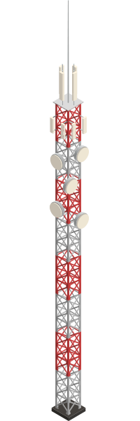 ADS-B is the major component of flight tracking worldwide. ADS-B flight tracking works by the aircraft broadcasting continuous data that is then picked up by ground receivers – from door close to take-off to landing. This data is then interpreted and visualized on a flight tracking map.
What’s fascinating is that many of these receivers around the world are installed by amateur flight tracking enthusiasts. These flight trackers exist on houses, on towers, and on thousands of structures around the globe. Each receiver allows ADS-B to paint a more perfect picture of the legions of planes across the sky – making flight tracking more robust and simple than ever.
But what about oceanic flights? Good question! The Earth is over 70% water, and these bodies of water are not conducive to having trackers installed within them. Our radar works with ground receivers, so there are gaps far out over the ocean. Where a flight leaves receiver range, the map continues its last known course and speed as an estimated position, drawn translucent and labelled as estimated: a few minutes for a low-flying aircraft, several hours for a long-haul flight at cruising altitude. You can still look up any flight by its number at any time.
Around 70-80% of all commercial aircraft use ADS-B, with over 80% of flights in Europe using ADS-B and around 60% of US flights being outfitted with ADS-B technology.
The technology itself was only rolled out starting in 2006. Since then, it has gained a reputation for being a key and critical component of flight tracking worldwide, with scores of countries working diligently to upgrade fleets and rollout additional receivers to ensure that flight tracking is as robust as technologically possible. In the United States, ADS-B Out has been mandatory in controlled airspace since 2020, and Europe introduced a similar requirement. As a result, virtually every commercial aircraft flying today broadcasts its position via ADS-B, with radar and MLAT acting as a backup rather than the primary source.
Why is ADS-B so important?

ADS-B allows for the continuous broadcast of location by the aircraft – meaning that the aircraft itself lets the receivers know where it is, in real-time. Therefore, tracking doesn’t need to rely on traditional radar to find it. It’s already announcing its position.
ADS-B provides many benefits over traditional radar or other flight tracking technologies.
ADS-B can provide the pilot with key information about other flights relative to his/her position, such as heading, distance, speed, and altitude.
ADS-B is also able to give the pilot key weather information, which will allow the pilot to make more informed flight decisions with regard to avoiding dangerous storms.
It’s this situational awareness for the pilot that is a significant improvement over other traditional flight trackers. Situational awareness leads to an increase in flight safety and a decrease in flight accidents. ADS-B’s robust capabilities improve situational awareness through real time weather, aircraft, and flight restriction information.
ADS-B provides the pilot, the passenger, and air traffic controllers with a much more accurate location of each aircraft, which allows for ease of maneuvering planes in and out of crowded airspace with relative ease. This increase in maneuvering leads to a decrease in flight times, runway crowding, and delays. This means that customers arrive to their final destination in a faster, safer, and smoother manner.
What other types of flight tracking are there?
We’ve covered traditional + Doppler radar, as well as ADS-B. In addition to these two types of flight tracking, there are a few other forms of technology that can track flights.
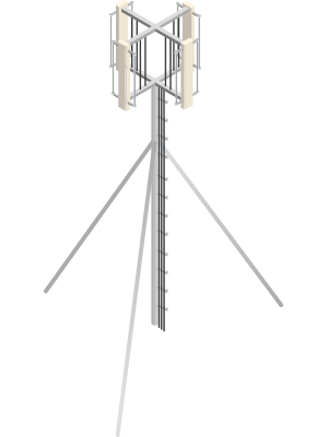
For flights that do not transmit ADS-B, there is MLAT or multilateration for flight tracking. MLAT is akin to ADS-B or traditional radar, and can be thought of as a hybrid of the two. MLAT transmitters on an airplane broadcast a frequency that is picked up by receivers. When the transmission is received, the receivers are able to calculate the distance traveled through a concept called TDOA or timed difference of arrival. This is not unlike tracking through Doppler radar – the difference being that the plane itself is broadcasting a transmission. Many flights in North America and Europe still don’t have access to ADS-B transmissions, and the MLAT tool allows flight tracking to still remain robust.
After MLAT, there is also FLARM, which is a simplified version of ADS-B typically used for small aircraft, as its range is significantly smaller – less than 100km. For comparison ADS-B covers well over 250km. In some extraordinary cases, coverage can reach up to 400km!
Combining MLAT, FLARM, ADS-B, and government radar data allows flight tracking software to portray a highly accurate picture of any commercial flight in the air at any given time.
Why is radar still so important?
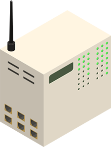
Radar is still a key component of flight tracking. Even if a plane has an ADS-B transponder, radar provides a critical backup in case that transponder stops working. Radar, since the data is created by a source outside of the aircraft, is able to locate aircraft even if they are not broadcasting their location.
What other ways can I track a flight?
 Flight tracking isn’t just limited to plugging in its flight number. There are a number of ways that you can use flight tracking to identify a flight, figure out its final destination, or figure out its flight history.
By using a live plane finder, you are able to see air traffic over an airport or geographic area. Using this as a starting point, you can filter out data to then figure out what specific flight might be overhead or landing near your specific location.
On our radar you can also press the Above me button: allow your location and the radar lists the aircraft nearest to you, so you can identify what is passing overhead, with photo, route, altitude and speed.
If you know a flight’s specific location, you are also able to use the map to physically find the plane yourself!
How can I access flight tracking?

All you need is a tablet, computer, or smartphone. On a computer, simply go to https://flight-tracking.org in order to access our flight tracking module. On a phone the radar works in the browser, full screen if you like; no app needed. Press Follow to keep your flight centred and Share to send the link, so you keep an eye on your flight all the way to the airport.
Are there any flights I cannot track?
Some. Aircraft that do not transmit their position, or that are filtered from public data (a small number of government and private flights), are not shown. Military aircraft that do transmit are shown on our radar and marked as military; helicopters and business jets appear too.
With thousands of flights every day, it would take lifetimes to comb through all of the fascinating and mesmerizing flight patterns and visualizations that are recorded.
How does flight tracking help in the event of a crash?
Crashes in airlines are extremely rare. Today, the rate of fatal accidents is one in over 2.5 million flights – with 556 people perishing in a plane accident. In the United States, car crash fatalities accounted for over 36,000 deaths in the same time period.
Still, accidents do happen, and flight tracking data can be an integral part in helping locate the missing airliner.
Since flights using ADS-B data broadcast their position continuously, air traffic control centers can see when a flight has veered off course. Additionally, after an accident, flight tracking data can show altitude, velocity, acceleration, and last broadcast location, which allows investigators to create a more whole picture of how the crash occurred.
Flight tracking data has been critical in helping conclude investigations into recent aircraft accidents such as Ethiopian Airlines Flight 302.
When ADS-B flight tracking technology is combined with traditional radar and MLAT, investigators and researchers can work quickly to find downed aircraft if they have stopped broadcasting, or fallen off of the map of one service. While ADS-B is a groundbreaking technology, it is the union of all these flight trackers that allows investigators to gain a comprehensive picture of any accident around the world.
What does our flight radar offer?
Our flight radar is free, needs no account and no app, and runs on our own platform. It is fed by a worldwide network of ADS-B receivers plus our own receiver, refreshed roughly every 12 seconds; between updates the aircraft move smoothly along their course.
Look up any aircraft in the world
Type a flight number, registration or callsign in the search on the map and the map flies to that aircraft, wherever it is. Type an airline or an aircraft type, such as A320, to highlight those aircraft and dim the rest. Type an airport code or a town to fly the map there. Press Above me and the radar lists the aircraft nearest to you.
What you see when you click
A photo of the aircraft, its flight number, the route with airport and city names, a progress bar with the distance and time to go, altitude, speed, heading, climb or descent, squawk with its meaning, registration with country, aircraft type and the place it is flying over right now. For many flights over Europe you also see the wind and outside temperature at its altitude, and a graph of altitude and speed builds up while you watch. The Previous tab lists the flights this aircraft made over the past 10 days, from our own log.
Follow, share and units
Press Follow and the map keeps the aircraft centred until you drag it. Press Share to send the flight via WhatsApp, e-mail or a copied link; the link opens that flight directly. Switch units between metric, imperial and aviation (feet, knots); your choice is remembered. A day and night shading shows where the sun is, and the fullscreen button gives the radar the whole screen.
Coverage and estimated positions
Coverage is best where receivers are dense: Europe, North America and other populated regions. Where an aircraft leaves receiver range, far out over the sea or at low altitude, the radar continues its last known course and speed as an estimated position, drawn translucent, until it is received again.
Is it free?
Yes. Everything on the radar is free, without registration.
Can I help flight tracking?
 Absolutely. For less than 100 dollars you can set up a small ADS-B receiver at home and feed the community networks that our radar draws on; every receiver adds coverage, especially at low altitude and away from the big cities. We run a receiver ourselves. Feeding data is the backbone of flight tracking and allows millions of people to follow flights in real time.
Flight Tracking growth
 Flight Tracking has entered an exciting and explosive new phase of growth and innovation. Through the introduction of ADS-B technology, flight tracking is able to pinpoint where commercial flights are in real time around the globe. This breakthrough technology allows the flights themselves to broadcast their location to thousands of receivers that interpret the data, allowing informed travelers to visualize any flight pattern in real or historical time by simply entering in a flight number.
On our radar you go a step further without a subscription: press the Above me button and the radar tells you which aircraft is passing overhead, with photo, route, altitude and speed.
It’s an exciting time to get into flight tracking, whether you’re a die-hard enthusiast, or simply a traveler who wants to know if you’re going to make that next flight. All you have to do to get started is enter that flight number at the top of our page.